Dodge County Crop Condition Tour – June 1
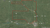 Figure 1. Major soil associations (colored polygons) in Dodge County are used to segment the crop condition report due to difference in soil texture, drainage, and topography. In this report, I will use the definitions used by USDA-NASS for crop conditions: General crop conditions. The county’s entire crop should be assigned a percentage by category, […] Continue reading →