2015 Dodge County Crop Yield Tour
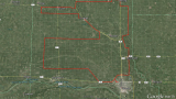
 2015 Dodge County Crop Yield Tour: September 1-4 by Nathan Mueller Note: Summary tables provided at the end of the blog post. Corn Yield Estimation Method: Stop at random fields along a predetermined driving route through Dodge County (Map). Walk past all end rows and then walk another 60 feet or more into the field. […] Continue reading →